
Maryport Roman Fort
MARYPORT SENHOUSE SITE
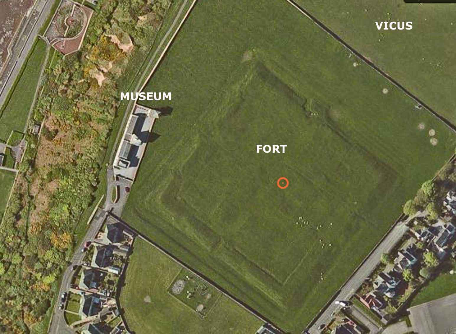
Maryport Roman Fort/Alavna and Senhouse Museums are located on the cliffs North of the town with the Isle of Man and the south coast of Scotland, visible on a good day.
It is in the middle of the coastal defences, 24 miles from Bowness on Solway ( end of Hadrian’s Wall see the guide) in the North and 26 miles from Ravenglass ( see the guide) in the South. As the larger fort with the largest garrison with the only Tribune ( smaller forts had a Prefect). It is probably that he controlled all the coastal fortifications.
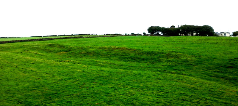
The only visible stonework is beside the north gate. The site has been extensively robbed and the majority of the earthworks are as a result of stone-robbing.
The lumps that can be seen are from the time of the Wall, 120’s AD. The fort was unusual in so far it was square measuring 461ft by 479 ft. This represented 5.1 acres, about the same size as Housesteads.
The ramparts are a maximum of 10 ft high. The positions of angle towers and, on the west side, interval towers are discernible as platforms interrupting the course of the rampart. It is known from 18th century excavations that the headquarters building and the commanding officer’s house occupied part of the central range. Their positions are marked by a number of low linear scarps. A series of deep robber trenches on the South side of the interior of the fort may be the robbed remains of barrack blocks. The partial remains of furrows and the smoothed appearance of some of the earthworks demonstrate that the interior of the fort has been ploughed. It had the usual double gates and a large strong room in the headquarters building and was occupied at the end of the 4th century.
Maryport-Fort-NW-corner
The fort was garrisoned by the 1st Cohort Spaniards, a military mixed cohort of 1,000 men ( 800 infantry and 240 cavalry). during the 2nd century. From altars found on the site, we know the commanders of the cohort.
It is probably, it was not the first fort on the site as coins have been found that predate the fort. Also, the road from the North East does not align with the visible fort. KickbrideRoman Fort 15 mile North certainly dates back to Circa 80 AD.
The Civilian Settlements ( Vicus)
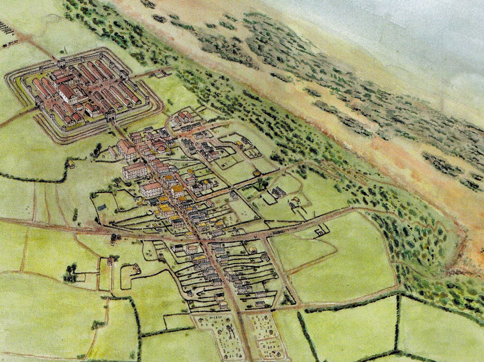
Maryport Fort and Vicus
The Site
The site of the Roman vicus at Maryport which dates to the 3rd or 4th century, identified as crop marks on air photographs and by geophysical survey. The crop mark covers an area of approximately 40 acres to the north-east of the fort. This includes the vicus and the Roman roads and a subsidiary trackway, which were flanked by numerous rectangular buildings and enclosures. The regular form of some of these enclosures is paralleled in other vici, representing land division into `fields’ or garden plots. The survey revealed the extent of the vicus and reflects a complex multiphase settlement. The later geophysical survey (2000-2004) has revealed further details for the vicus. There appear to be 40 to 50 houses, some lining the road north, some quite large and at least 2 temples.
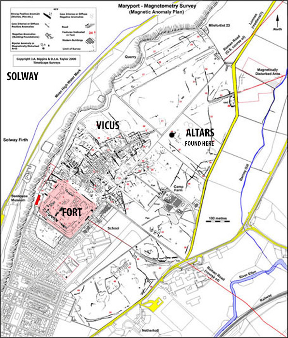
MARYPORT ROMAN SITE-GEOPHYSICS
The Altars
In 1870 300yds north east of the fort 17 altars dedicated to Jupiter were discovered buried in the ground under a number of pits. They appear to be an annual dedication to god in the 2nd century AD. The mystery was how they got there and whether was there a religious significance. This has been argued for over 100 years. Newcastle University, Senhouse Trust and Hadrian’s Wall Heritage Ltd organised an excavation programme led by Ian Hayes and Tony Willmott to find the answer.
The answer was they were used as blasts in the foundations of a later large wooden building in the 4th century. In 2012 an eighteen altar was found, again from the foundations of the new building. Dated to the 2nd or 3rd Century AD, it was inscribed on behalf of Titus Attius Tutor, commander of the First Cohort of Baetasian, which came to Maryport from what is now the Netherlands and again dedicated to Jupiter, (IOM) As of early 2015 the original location of the altars has not been found, but it is thought that it was in a shrine not far from the pits in the vicus. In this second excavation, a fragment of an altar removed in 1870 was found in the foundations.
Senhouse Museum
The Museum
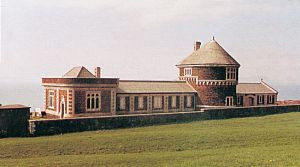
MARYPORT SENHOUSE MUSEUM
The collection was started in 1570 by John Senhouse (the local Lord of the Manor), who owned the site of the fort and its civil community and collected all artefacts found on the site. His family continued the collection over the centuries, including the altars found on site.
In 1990 the collection was transferred to the former Naval Battery, and a trust was established, artefacts were loaned to the Trust (by the family for 125 years) and its chairman was Prof David Breeze until recently.
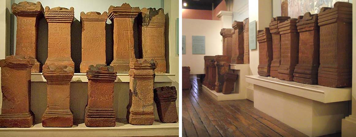
MARYPORT SENHOUSE ALTERS
The museum has good models of the fort and its buildings.
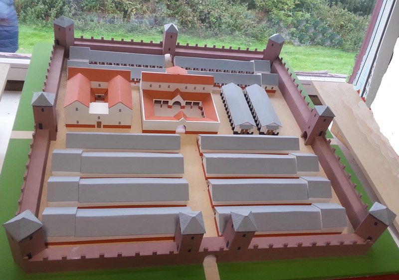
Maryport-Fort-Model
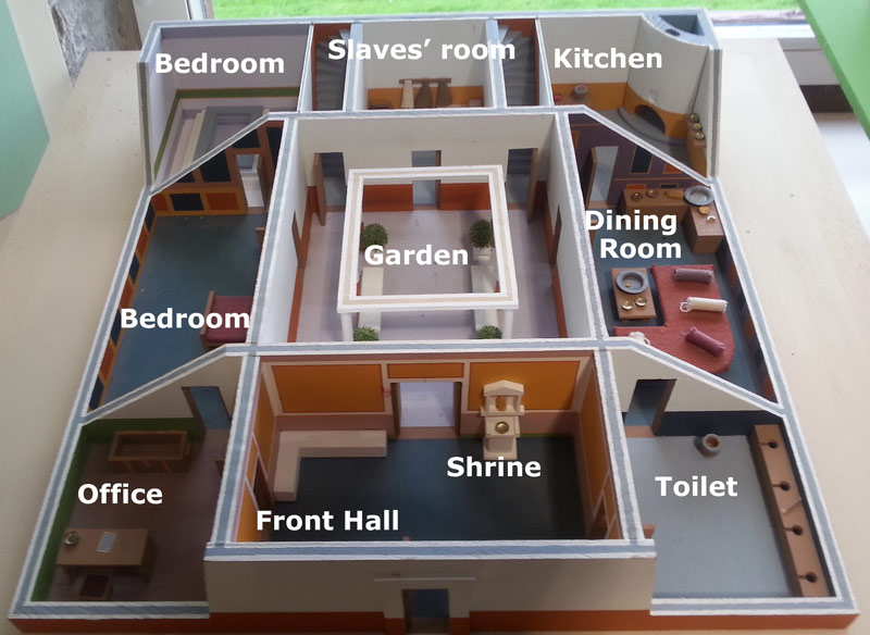
Maryport-Fort-Commander’
Links

Maryport-Temple-Project Click the picture